Food, Floods, Erosion: 16,140 households targeted with 5,380 tubewells, dams, irrigation projects in Kano
Among the locations listed are Zambur, Unguwar Gai in Kibiya Local Government Area, Rimmin Yamma and Sumaila, Rurum-Bunkini-Kazaurawa, Furuwa, Kibiya town bypass, Zango and Hanyar Kogo in Takai, Kachako, Karaye, Kukar Bashari and Kwanar Dan Goro. Other locations include Fulatan in Rogo Local Government Area, Kadabo Road, Darki bypass in Wudil, Kiru, Tiga-Runum Road, Gala, Wudil town, Daki community, Bebejii, Kadauji village and Magami.
•Inside the Ecological Project Office interventions in dry-season farming By Nnamdi Ojiego For farmers in Kano State, the end of the rainy season often marks a difficult transition. As rainfall declines, access to water becomes a major concern, particularly for smallholder farmers who depend on seasonal rains to cultivate their land. In communities exposed to flooding and erosion, the challenges are even greater, with damaged roads, threatened homes and disrupted economic activities adding to the difficulties of rural life.
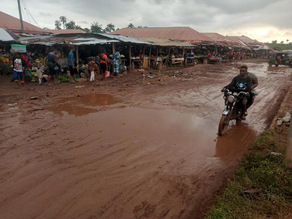
In Sumaila Town, Sumaila Local Government, for instance, residents faced serious challenges due to a lack of accessible roads and the threat of gully erosion. Vehicles could not enter parts of the neighbourhood, forcing car owners to park outside. Against this backdrop, the Federal Government has embarked on a series of ecological and agricultural interventions across Kano State, combining flood control, erosion remediation, road improvement and irrigation infrastructure in a programme intended to support farming throughout the year.
The projects, implemented by the Ecological Project Office under the leadership of Permanent Secretary, Office of the Secretary to the Government of the Federation, Dr. Aishetu Gogo Ndayako, include interventions in communities spread across several local government areas, as well as irrigation schemes linked to Tiga, Challawa-Gorge and Kafin Chiri dams.
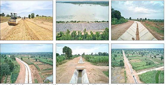
Project documents obtained by Sunday Vanguard indicate that the programme covers erosion control, flood mitigation, the construction of bridges and culverts, improvements to rural roads, the provision of tubewells and pumping machines, and the development of canal networks to supply water to farmland. A separate watershed management programme lists 18 projects involving the provision of 5,380 tubewells and an equal number of pumping machines, with 16,140 households identified as intended beneficiaries.
The programme is reported to have achieved an average completion rate of 99.7 per cent, according to a brochure published by the Ecological Project Office. The interventions form part of the Federal Government’s special ecological programme for the Kano River Irrigation Project under President Bola Tinubu’s Renewed Hope Agenda. Beyond the number of projects and facilities listed, the programme raises important questions about the relationship between water management, agricultural productivity, rural infrastructure and the ability of farmers to sustain production beyond the rainy season.
Ecological interventions The erosion and flood-control component of the programme covers a range of communities where the government has listed projects intended to address erosion, flooding and deteriorating road infrastructure. The project schedule contains 32 entries, including the construction of bridges and culverts for flood control, erosion-control works, remediation of affected areas and road improvement along selected routes.
Among the locations listed are Zambur, Unguwar Gai in Kibiya Local Government Area, Rimmin Yamma and Sumaila, Rurum-Bunkini-Kazaurawa, Furuwa, Kibiya town bypass, Zango and Hanyar Kogo in Takai, Kachako, Karaye, Kukar Bashari and Kwanar Dan Goro. Other locations include Fulatan in Rogo Local Government Area, Kadabo Road, Darki bypass in Wudil, Kiru, Tiga-Runum Road, Gala, Wudil town, Daki community, Bebejii, Kadauji village and Magami.
The programme also lists road improvement and erosion-control works along Sabon Gwandu, Kazaurewa-Gana Road in Rano, Unguwar Gora, Rano-Bunkure Road and Falali in Sumaila, among other locations. The projects vary in their stated purposes. Some are primarily concerned with erosion control, while others combine erosion remediation with road improvement.
Several involve the construction of bridges or culverts intended to help manage flooding and improve movement within affected communities. Such infrastructure can be important in rural areas where roads provide links between farms, residential settlements, markets and other essential services. Where erosion damages roads or floodwaters cut off access, farmers may encounter additional difficulties moving produce to buyers, obtaining agricultural inputs or reaching their fields.
The listed interventions therefore have potential implications beyond the physical structures being constructed. Their value to communities will depend on whether they address the problems for which they were designed and whether the infrastructure remains functional after construction. Challenge of flooding, erosion Flooding and erosion can place considerable pressure on communities whose livelihoods depend on agriculture and local trade.
Heavy rainfall can wash away topsoil, damage roads, undermine structures and disrupt the movement of people and goods. Where water is poorly channelled, runoff can gradually erode the land, deepen gullies and threaten farmland and residential areas. Flooding can also make roads impassable, leaving some communi
- erosion
- project
- road
- irrigation
- kano
- government
- programme
- control