This search and rescue robot creates 3D maps of disaster areas

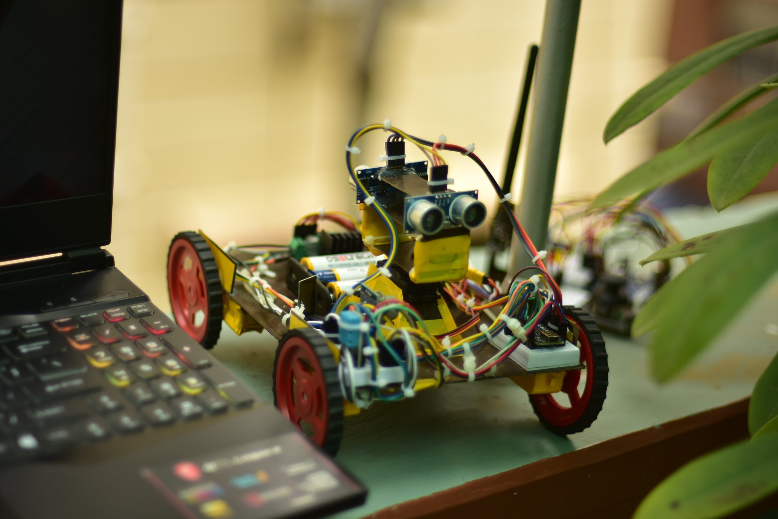
If you look at footage of search and rescue efforts after a disaster, you'll see first responders struggling to navigate the rubble to find people in need of emergency care. They also need to take extra precautions, as gas line breaks and other hazards present hazards they don't normally face. To help with these efforts, Ranit Bhowmick and her team built the SARDA (Search and Rescue Deployable Assistant) robot that can create 3D maps of disaster areas.
SARDA is currently a first prototype and its capabilities are limited, but the idea is good. It's a small wheeled robot that (in theory, at least) would move around a disaster area while mapping its surroundings. It could work autonomously or an operator could guide it manually. As it moves through an area, it would generate a 3D map of rigid objects, like walls and obstacles, as well as health hazards like clouds of smoke, heat, or toxic gases. A computer at a control station would use this data to produce a digital 3D rendering of the environment that first responders could refer to during their search and rescue efforts.
The robot is affordable to build and uses only off-the-shelf components. These include an Arduino Nano board, a pair of ultrasonic distance sensors, a temperature and humidity sensor, and a smoke sensor. The Arduino controls the drive motors through the L239D drivers. The RCU (receiver and controller) contains an Arduino Uno and communicates with SARDA via a pair of nRF24L01 radio transceiver modules.
Bhowmick and his team created SARDA for a science fair and it's rudimentary, but functional. Mapping software can only generate simple blocks where ultrasonic sensors detect obstacles and positioning is based solely on open feedback motor control. But it's a good start and something to build on.
What's Your Reaction?